
Scotland is 98% rural by land, yet only 17% of its people live in those rural areas. That split explains more than a postcard ever will. The country looks wide open on a map, but its daily life is pulled toward a few dense places.
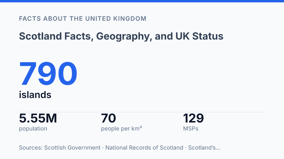
It occupies the northern third of Great Britain, sits inside the United Kingdom, and reaches far beyond the mainland through 790 islands. Only 93 are inhabited. That gap matters.
The population reached 5,546,900 in 2024, helped by migration even as deaths outnumbered births. So this isn’t a simple story of mountains, cities, and accents.
It’s about scale, uneven settlement, political identity. A country that belongs to the UK without becoming a regional footnote. In my honest opinion, that tension is the part most quick facts pages miss.
Where Scotland sits in the United Kingdom
The UK’s northern third is not a region of England. Scotland is a country that forms part of the United Kingdom. It is not a separate sovereign state. That distinction matters: you can point to it on a map as a defined place, but its international state is the UK.
The Scottish Government describes the country as part of the UK, occupying the northern third of Great Britain and including almost 800 small islands. That puts it north of England, with the Atlantic to the west and the North Sea to the east. Its position makes it both mainland and maritime at once.
The political frame dates to 1707, when the Acts of Union joined Scotland and England into Great Britain. In 1801, Great Britain joined with Ireland to form the United Kingdom.
That history gives the country its UK status. It doesn’t erase its separate legal tradition or national identity.
Its weight inside the UK is also demographic. The 2022 population was about 5.4 million.
This is not a small border province or a remote appendage. It accounts for a major share of the UK’s land, institutions, and public life.
Here is the useful tension: the country sits fully inside the United Kingdom. It still has clear geographic boundaries, a strong national name, and its own legal system. In my view, that dual status is the detail that makes the place easiest to misunderstand and most important to describe precisely.
The landmass, islands, and major regions
The country’s map is easy to misread: the mainland draws the eye. The islands decide much of how movement, weather, and services actually work.
Its core landmass sits on the northern part of Great Britain. The name should never be treated as a label for the whole island.
The physical split is clearer when you look beyond political borders. Mountainous northern and western areas give way to lower, more settled ground farther south and east.
Size matters here. The total area is about 8 million hectares, according to the Scottish Government. That scale makes the country feel far less compact than a UK map can suggest.
The Highlands take up a huge share of the north and west. They don’t function like one single block. Sea lochs, peninsulas, glens, and ferry routes break the region into smaller lived geographies.
Off the west coast, the Hebrides form the main island world, split into the Inner Hebrides and Outer Hebrides. That split isn’t just a cartographic detail. It affects school travel, health access, freight, fuel costs, and how exposed communities are to Atlantic weather. In my honest opinion, this is the part most simple maps hide.
North of the mainland, the Northern Isles are led by Orkney and Shetland. They face different seas, different weather systems, and different travel patterns from the western islands. The obvious picture is a mainland country, but these island territories matter just as much… and they shape daily life in ways a road atlas can’t show.
The broad regional frame stays useful: Highlands to the north and west, Central Lowlands through the main belt of settlement, and Southern Uplands toward the border country. But it’s a rough guide, not a clean division.
Physical geography here resists neat boxes. Coastlines, water crossings, and upland interiors keep complicating the map.
Population, cities, and where people live
A country can be 98% rural by land and still place most of its residents in a handful of dense urban regions. That is the central population puzzle here.
The 2022 total of about 5.4 million sounds modest for a whole country. The distribution matters far more than the headline count.
According to the Scottish Government, rural areas make up 98% of the landmass but contain only 17% of the population. That creates a sharp contrast. You can travel through wide, quiet areas and still be in a country where daily life is heavily shaped by cities, commuter belts, hospitals, universities, and rail links clustered in the mainland center.
Glasgow is Scotland’s largest city and the clearest example of that concentration. National Records of Scotland estimated Glasgow City at 650,300 people in mid-2024, making it the country’s biggest urban hub by local authority population.
Its role isn’t just size. It anchors work, culture, education, and transport for a much wider city region.
Edinburgh works differently. The capital had an estimated 530,680 people in mid-2024, according to National Records of Scotland, and its weight comes from government, finance, education, tourism, and administration. It is smaller than Glasgow, but its institutional pull is huge. In my humble opinion, that split between political capital and largest city is one of the details that makes the settlement pattern easy to misunderstand.
Density shows the same imbalance in harder numbers. Scotland’s Census recorded 70 residents per square kilometre in 2022, compared with 395 in England and Wales. Inside the country, the gap is even starker: Glasgow City reached 3,555 residents per square kilometre, while some island and remote mainland areas sit at single-digit levels.
That contrast shapes practical life. Roads, ferries, schools, emergency care, broadband, and public transport all face different pressures depending on where people live.
The country may feel open and thinly settled across large areas, but most residents don’t live in those spaces. They live in dense mainland population zones, and policy has to serve both realities at once.
What makes Scotland distinct inside the UK
A resident can use a different school system, court system, and health service without leaving the UK. That is the practical difference people feel first.
The border on the map matters. The institutions matter more.
The clearest marker is the Scottish Parliament, which has 129 MSPs according to the Scottish Parliament. It controls devolved areas such as health, education, justice, local government, and parts of transport. But Westminster still controls reserved matters such as defense, foreign affairs, immigration, and major economic policy.
The constitutional story still turns on 1707. That date anchors the country’s modern place inside Great Britain. It didn’t wipe away separate systems.
The result is not simple central rule. It’s a shared state with real internal difference.
Identity makes that difference visible every day. The saltire is the obvious symbol, but Scots law may matter more in daily life because it shapes courts, property, and legal procedure. Gaelic and Scots also remain part of national identity: the 2022 Census recorded 130,161 people with some Gaelic skills and 2,444,659 with some Scots skills, according to the Scottish Government.
That creates a neat constitutional tension. Scotland is not just another UK region. It has powers and institutions of its own, but those powers sit inside a union that still shapes its biggest decisions. In my view, that tension is the most interesting fact about Scotland.
What the map can’t tell you on its own
The next question isn’t where Scotland fits on the UK map. It’s how much difference a country can keep making inside a union that also binds it.
The Scottish Parliament gives that difference a formal shape, with 129 MSPs debating laws from Edinburgh rather than Westminster alone. Gaelic and Scots gaining official status from 30 November 2025 adds another layer. Language turns identity into policy, not just memory.
But maps can still mislead you. A country can be mostly rural and mostly urban in lived experience. It can be part of a state and still feel institutionally separate. In my humble opinion, that’s why the real story starts after you know the facts.
Frequently Asked Questions
Q: Is Scotland a country or just part of the UK?
A: Scotland is a country, and it’s part of the United Kingdom. That distinction matters, because it has its own legal system and national identity, even though it shares a state with England, Wales, and Northern Ireland. People mix that up all the time.
Q: Where is Scotland located exactly?
A: It sits in the northern part of the island of Great Britain. It also includes nearby islands, especially the Hebrides and the Northern Isles. That geography gives it a much larger island footprint than many people expect.
Q: How many people live in Scotland?
A: In 2022, Scotland’s population was about 5.4 million. That’s smaller than London’s metro area. It still makes Scotland one of the UK’s major population centers. In my view, that scale is part of what makes its cities and rural areas feel so different from each other.
Q: What islands are part of Scotland?
A: Scotland includes several island groups. The best-known are the Hebrides and the Northern Isles. Those islands are not a side note… they’re a core part of the country’s geography and identity. If you’re planning a trip, they can change the whole experience.
Q: Why does Scotland have a different identity from the rest of the UK?
A: Scotland has its own history, institutions, and cultural traditions. It doesn’t feel interchangeable with the rest of the UK. It’s part of the same country-level political union. It keeps a separate identity that people notice fast. That split is the point, and it’s what makes Scotland stand out.