
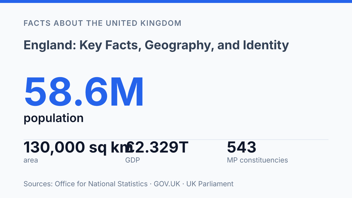
England holds 58,620,100 people in 2024, so one UK nation contains about 84.6% of the population but only just over half the land. That imbalance is the key to understanding why maps, passports, flags, and politics can point in different directions at once.
The Office for National Statistics gives the demographic scale. The sharper question is identity. In Census 2021, 56.8% in the country selected “British only,” while 15.3% selected “English only.”
That contrast matters. It shows a place that dominates the UK numerically, yet still shares power, borders, and names with Scotland, Wales, and Northern Ireland.
This guide looks at the country inside the UK structure, its land and sea edges, the difference between English and British identity, and why its weight still shapes daily life. In my honest opinion, the real story is not dominance alone. It’s dominance inside a union.
Where England sits inside the United Kingdom
England covers nearly two-thirds of Great Britain. It is not a sovereign state of its own. That contrast matters.
Size gives the country huge weight inside the United Kingdom. It doesn’t make it independent from the UK’s shared institutions.
England is one of the four countries of the United Kingdom, alongside Scotland, Wales, and Northern Ireland. Three of those countries sit on Great Britain; Northern Ireland is across the Irish Sea on the island of Ireland.
So when you hear “Great Britain,” think island. When you hear “United Kingdom,” think political union.
The country occupies the southern and central part of Great Britain and covers about 62% of the island. It also includes more than 100 smaller adjacent islands, so its geography is not limited to the mainland outline most people picture on a map.
The political setting is older than the modern shorthand makes it sound. England and Scotland became “one Kingdom by the name of Great-Britain” on 1 May 1707, according to the House of Commons Library. That date helps explain why the largest part of Great Britain is still part of a wider state, not a standalone country in international law.
This is where many mix-ups start. The country is dominant in area and population, but “English,” “British,” and “UK” don’t mean the same thing. In my view, that distinction is the key to understanding the rest of the map without getting trapped by everyday language.
Borders, coastlines, and nearby neighbors
The country’s most direct route to continental Europe runs beneath water, not over land. The Channel Tunnel links England with northern France below the English Channel, turning what looks like a hard sea boundary into a fixed transport connection.
That contrast matters. The country feels island-bound on a map, but one of its closest international links is hidden under the seabed.
On land, England shares borders with Scotland to the north and Wales to the west. The Scottish boundary runs for about 154 km and is crossed by 21 roads and 2 railway lines, according to GOV.UK. Its legal basis goes back to the Treaty of York in 1237, a reminder that this line is old, but not just symbolic.
The Welsh border works differently in daily life. UK Parliament data from 2013 put it at 160 miles long, with 138 million road and rail journeys crossing it each year. That number shows how porous the boundary is in practice.
People may notice the change in signs, language, law, or administration. The movement across it is constant.
Water frames the rest of the country. Its eastern side faces the North Sea, the south faces the English Channel, the west meets the Irish Sea. The southwest opens toward the Atlantic Ocean. In my honest opinion, that four-sided exposure is the key geographical fact people miss: the country is not just bordered by water, it is shaped by different seas with different routes, weather, and pressures.
Still, coastlines can mislead. They suggest separation.
They also create contact. Ferries, ports, fishing grounds, energy links, and undersea infrastructure make the surrounding waters less like walls and more like working edges.
How English identity differs from British identity
In Census 2021, people in the country chose “British only” far more often than “English only”: 56.8% selected British only, compared with 15.3% selecting English only, according to the Office for National Statistics. That gap matters. Identity here doesn’t follow the map as neatly as outsiders expect.
English refers to people, culture, and institutions tied to England itself. That can mean the English legal system, the Church of England, English literature, or the national football team.
British refers to the United Kingdom as a whole. It is the broader state identity, used for passports, citizenship, foreign policy, and national government.
This is where the confusion bites. England is the name most people know. It is also the easiest one to mix up with Britain.
Calling every British person English erases the distinct identities of people from other parts of the UK. Calling English institutions British can also blur what is specific to the country itself.
The political setup adds another twist. The UK is the sovereign state. This country does not have its own devolved parliament.
Scotland, Wales, and Northern Ireland have separate devolved legislatures for many domestic matters. For English-only issues, decisions often run through the UK Parliament at Westminster.
That arrangement creates a strange imbalance. The largest national identity inside the state has the least separate political machinery of its own. In my humble opinion, that’s the detail most people miss: English identity can feel culturally dominant, yet constitutionally less distinct than the others.
Why England matters in UK history and life today
London answers to two jobs at once: it is the capital of both England and the United Kingdom. That dual role gives one city a pull that reaches far beyond its own boundaries. When people talk about UK politics, finance, media, or culture, they’re often talking about systems that run through the capital first.
England is home to the largest share of the UK population. The scale is not close.
In 2024, the country had 58,620,100 residents, about 84.6% of the UK’s 69,281,400 total, according to the Office for National Statistics. That means everyday UK life is shaped heavily by English schools, roads, housing markets, hospitals, workplaces, and elections.
National institutions reinforce that weight. Parliament meets at Westminster, the monarchy’s central ceremonial machinery is based around the capital, and many of the UK’s major museums sit in the same national orbit.
These places don’t just preserve history. They help decide what gets presented as shared British memory.
That central role creates influence. It also creates friction.
Power gathers in one place, then the rest of the country has to live with the results. In my view, the most overlooked fact about the UK is not that one part is larger. It’s that its size can make its dominance feel normal.
You can see the tension in public life. A policy announced for the whole UK may land differently outside the English majority. A national symbol may be read as British by some and English by others.
That overlap keeps the country central to UK history and daily life. It also keeps arguments about balance and identity alive.
The imbalance behind the map
England will keep shaping the UK less through symbolism than arithmetic: 543 of 650 Commons seats sit there, and economic weight follows the same pattern. But numbers don’t settle identity. They make the question harder.
The union formed in 1707 still asks a modern question. Can one nation hold most of the people, output, and political seats without flattening the others? The House of Commons makes that tension visible every election night.
The practical next step is simple. Say English when you mean English. Say British when you mean the shared state. In my humble opinion, that small habit does more than tidy language.
It respects the fault lines under the map. A country this dominant doesn’t need louder myths. It needs clearer words.
Frequently Asked Questions
Q: Is England a country or part of the UK?
A: England is a country, and it’s part of the United Kingdom. That trips people up all the time. It has its own identity. It shares the state with Scotland, Wales, and Northern Ireland.
Q: Where is England located?
A: England sits on the island of Great Britain. It covers about 62% of that island, which is a bigger share than many people expect. It also includes more than 100 smaller adjacent islands.
Q: How is England different from Great Britain?
A: Great Britain is the island. England is one part of it. The two aren’t the same, and mixing them up leads to sloppy geography fast.
Q: Does England have its own identity?
A: Yes. That identity matters. England has distinct traditions, history, and public symbols, even though it’s part of the UK. In my view, that blend of national identity and shared statehood is what makes it more interesting than people expect.
Q: How many islands are part of England?
A: England includes more than 100 smaller adjacent islands in addition to its main landmass. That detail surprises a lot of people. It’s not just the mainland you should picture.