
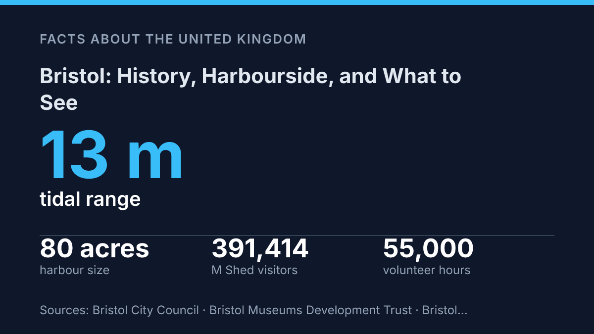
Bristol’s defining problem was never distance from the sea. It was a tide that could rise and fall by 13 metres, enough to leave ships stranded in mud between sailings. The answer was blunt, costly engineering: on 1 May 1809, the city opened a floating harbour that trapped 83 acres of water from the River Avon.
That single fix shaped the place you walk now. The working docks later lost their port role.
The waterfront didn’t become a museum piece. It became a test of what a city should do with industrial space after trade moves on.
Here, the story runs from tidal risk and dock labour to public quays, M Shed’s cranes, and Arnolfini’s warehouse gamble. In my honest opinion, the best way to read the Harbourside isn’t as a pretty riverside stroll. It’s as a city showing its working, with the joins still visible.
Why Bristol grew on the River Avon
A river that can rise and fall by up to 13 metres made this inland-feeling city rich before it made trade painfully complicated. The Avon has the second-highest tidal range in the world, according to 2026 city council data.
That wasn’t a minor quirk. It shaped almost every commercial decision made on the water.
Bristol grew where the River Avon cuts through southwest England toward the Severn Estuary and the Atlantic beyond. The city was not sitting on an easy open coast. It had something better for medieval merchants: a sheltered route inland, close to regional markets, yet still tied to sea lanes.
By the medieval period, the port handled cloth, wine, fish, salt, and other goods that moved through western Europe. Ships could reach Ireland, Iberia, and later wider Atlantic routes. That access turned river frontage into money.
The wealth had a harder edge too. Shipbuilding, repair yards, provisioning, and overseas commerce fed one another, but Atlantic trade also connected the city to colonial exploitation and slavery. In my view, the city’s maritime rise makes no sense if you strip away that uncomfortable part.
The river gave protection. It also demanded engineering.
Mud, tides, and narrow approaches made arrivals risky and delays expensive. The later Floating Harbour, opened on 1 May 1809, answered that problem by keeping ships afloat in the city docks at all states of the tide.
That solution shows the bigger truth. The same waterway that created prosperity also locked the city into the fortunes of shipping. When vessels changed, trade routes shifted, and larger ports gained the advantage, river-born wealth became less secure.
The Avon had made the city powerful. It never made that power permanent.
How the Harbourside changed from docklands to culture
Cargo doors that once took in goods now open onto coffee counters, gallery foyers, and dinner tables. That is the sharp trick of the Harbourside: the former city-centre port has not been erased. It has been repackaged for public life.
The scale still matters. According to Bristol City Council, the harbour covers about 80 acres, runs around seven miles inland from Cumberland Basin to Hanham Quay, and is the largest floating harbour in the UK.
That makes the waterfront more than a pretty edge to the city. It is a huge piece of urban infrastructure turned inside out for visitors.
The break came in 1975, when the old harbour stopped functioning as part of the commercial port. Heavy cargo work moved away.
The warehouses lost their original purpose. But their size, strong floors, water-facing entrances, and plain industrial character made them ideal for reuse.
Those 19th-century buildings now carry a very different economy. Restaurants fill spaces built for storage.
Shops sit behind brick fronts made for trade, not browsing. Cultural venues use the height, depth, and rough texture of old dock buildings to create rooms that feel connected to the working waterfront, even when the work has changed completely.
That change is easy to enjoy. It can be too clean a story. The polished quays, menus, and shop windows soften a harder docklands past of labour, risk, noise, and uneven profit. In my honest opinion, the best way to read the Harbourside is not as a rescue story, but as a conversion: the buildings survived because they could earn money again, just from different bodies moving through them.
What M Shed tells you about the city
Outside M Shed, four electric cargo cranes turn industrial history into something you can stand under, not just read about. Built in 1951, they connect the museum on the Harbourside to the work that once shaped daily life along the water. Their restoration has taken an estimated 55,000 volunteer hours, according to the museum’s cargo crane records.
That number says a lot. This place runs on memory as much as display cases.
The museum’s strength is its focus on local social and industrial heritage. It doesn’t treat the city as a postcard.
It looks at how people earned wages, moved goods, argued over space, and adapted when old industries faded. You come away with a sharper sense of shipping as a human system, not just a story of vessels and trade routes.
Dock labour sits at the centre of that story. M Shed helps explain the physical work behind cargo handling, the skills needed around cranes and quays. The insecurity that came with port employment.
But it also widens the frame. Transport, manufacturing, housing pressure, protest, migration, music, and neighbourhood change all appear as connected parts of city life.
That practical approach can feel plain beside grander civic museums. Good. In my humble opinion, its lack of polish is exactly why it works. A polished city showcase would flatten the awkward parts.
M Shed leaves room for friction: pride in engineering, anger over inequality, nostalgia for dock work. The hard fact that urban change creates winners and losers.
Its popularity proves the method lands. The museum welcomed 391,414 visitors from October 2024 to September 2025, according to the Museums Development Trust’s 2025 charity report.
That’s not just tourist traffic. It shows a local appetite for a museum that treats ordinary workers, streets, machines, and family stories as the real evidence of the city’s past.
Why The Arnolfini matters on the waterfront
The boldest thing about Arnolfini is that it made a derelict warehouse feel like a civic front door. It moved into Bush House in October 1975, according to Arnolfini’s own history. That timing matters.
The old dock economy was fading. The waterfront hadn’t yet settled into its new identity.
Its position does a lot of the work. The gallery sits in the harbour area inside a former 19th-century warehouse, with other converted dock buildings close by. You don’t approach it as an isolated art venue.
You meet it as part of the quay, the water, the brickwork. The reused commercial fabric around it.
That setting gives the place its edge. Inside, the programme points toward contemporary art, performance, film, talks, and experimental work. Outside, the building still carries the weight of trade and storage.
The contrast isn’t decorative. It’s the point.
The gallery gives the waterfront cultural status. It also exposes the tradeoff behind regeneration. A place once organized around ships, goods, and labour now draws people for exhibitions, cafés, bookshop browsing, and public events.
That shift has opened the harbour to far more people. It has also moved the area a long way from the working port that made it matter.
Arnolfini says research has linked the harbourside regeneration it helped spark to about £600 million of investment and more than 3,500 jobs. Numbers like that show influence beyond gallery walls. Still, money alone doesn’t explain its value. In my view, the real achievement is that it made contemporary art feel native to the waterfront rather than pasted onto it.
What the water still asks of the city
Treat the waterfront as a working argument, not a finished makeover. After 1975, the old docks could have become private flats with polite plaques. Instead, more than 80% of the harbour edge is public, and Arnolfini proved that art could pull serious money and jobs toward a derelict quay.
That doesn’t make the change simple. Regeneration always chooses what to save, what to soften, and what to price out. In my humble opinion, your next visit should be slow enough to notice those choices: the cranes outside M Shed, the warehouse brick, the water held still against nature. A city reveals itself in what it refuses to erase.
Frequently Asked Questions
Q: What is Bristol known for?
A: Bristol is known for its maritime history and its old port on the River Avon. The city built a lot of its wealth through trade, then turned that same waterfront into a cultural area. In my view, that shift is exactly why the city feels layered rather than polished.
Q: What can you do at Bristol Harbourside?
A: You can visit museums, eat in the old warehouses, and browse galleries and shops along the water. The Harbourside is a good place to see how the city reused its port rather than tearing it down. That choice gives the area more character than a standard waterfront district.
Q: Is the M Shed worth visiting?
A: Yes, if you want the story behind the city instead of just the postcard view. M Shed focuses on local social and industrial heritage. You get a clear sense of how Bristol changed. It’s a smart stop, especially if you care about history that feels connected to real places and people.
Q: What is the Arnolfini in Bristol?
A: The Arnolfini is a contemporary art gallery in the Harbourside’s old 19th-century warehouses. It’s one of the clearest examples of how the waterfront now mixes culture with everyday city life. That contrast matters… old industrial walls, new ideas inside them.
Q: Why is Bristol’s harbour area so popular with visitors?
A: It packs a lot into one walkable area: history, food, art, and waterfront views. The harbour’s old warehouses now hold restaurants, shops, and cultural spaces, so you’re not just looking at the past. You’re moving through it. In my honest opinion, that’s what makes the area worth your time.